The Digital Sanborn Maps database has been upgraded to the more modern ProQuest interface. The new look features:
- Updated full-screen modern map viewer with the ability to easily zoom, pan, scroll and reset your view with a pointing device
- Printed maps will now have citations and source URLs
- Improved mobile responsiveness when using a variety of tablets and larger devices
About Sanborn Maps
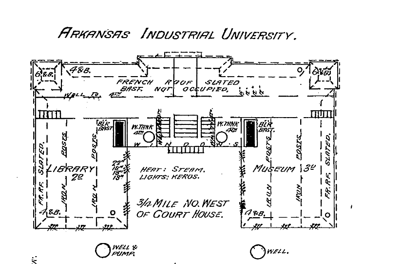
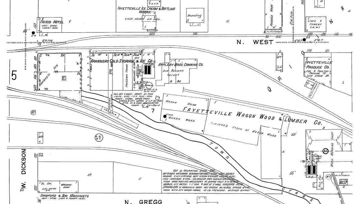
If you have never used Sanborn maps before: prepare to lose yourself in the past. Drawn at a scale of 50 feet to one inch, these detailed plans were created for insurance purposes and so show the type of structure (home, shop, tavern, warehouse, stable, and more) and construction (masonry, wood, stucco, and more). It’s the most feasible form of time travel.
Although fire insurance maps were produced for more than 12,000 towns and cities throughout the U.S., the Libraries subscribe only to the maps for Arkansas. The following towns are included in our subscription; most maps data from the 1890s – 1920s.
-
- Alma [Crawford Co.]
- Alpena [Boone Co.]
- Altheimer [Jefferson Co.]
- Altus [Franklin Co.]
- Amity [Clark Co.]
- Arkadelphia [Clark Co.]
- Arkansas City [Desha Co.]
- Ashdown [Little River Co.]
- Atkins [Pope Co.]
- Augusta [Woodruff Co.]
- Bald Knob [White Co.]
- Batesville [Independence Co.]
- Bearden [Ouachita Co.]
- Beebe [White Co.]
- Benton [Saline Co.]
- Bentonville [Benton Co.]
- Berryville [Carroll Co.]
- Black Rock [Lawrence Co.]
- Blytheville [Mississippi Co.]
- Bonanza [Sebastian Co.]
- Booneville [Logan Co.]
- Branch [Franklin Co.]
- Brinkley [Monroe Co.]
- Buckner [Lafayette Co.]
- Cabin Creek [Johnson Co.]
- Cabot [Lonoke Co.]
- Calico Rock [Izard Co.]
- Camden [Ouachita Co.]
- Carlisle [Lonoke Co.]
- Casa [Perry Co.]
- Charleston [Franklin Co.]
- Clarendon [Monroe Co.]
- Clarksville [Johnson Co.]
- Coal Hill [Johnson Co.]
- Conway [Faulkner Co.]
- Corning [Clay Co.]
- Cotter [Baxter Co.]
- Cotton Plant [Woodruff Co.]
- Crawfordsville [Crittenden Co.]
- Crossett [Ashley Co.]
- Danville [Yell Co.]
- Dardanelle [Yell Co.]
- De Queen [Sevier Co.]
- De Valls Bluff [Prairie Co.]
- De Witt [Arkansas Co.]
- Decatur [Benton Co.]
- Delight [Pike Co.]
- Dermott [Chicot Co.]
- Des Arc [Prairie Co.]
- Dierks [Howard Co.]
- Dumas [Desha Co.]
- Earl [Crittenden Co.]
- El Dorado [Union Co.]
- England [Lonoke Co.]
- Eudora [Chicot Co.]
- Eureka Springs [Carroll Co.]
- Fayetteville [Washington Co.]
- Fordyce [Dallas Co.]
- Foreman [Little River Co.]
- Forrest City [Saint Francis Co.]
- Fort Smith [Sebastian Co.]
- Fulton [Hempstead Co.]
- Gentry [Benton Co.]
- Glenwood [Pike Co.]
- Gould [Lincoln Co.]
- Gravette [Benton Co.]
- Green Forest [Carrol Co.]
- Greenwood [Sebastian Co.]
- Gurdon [Clark Co.]
- Hackett [Sebastian Co.]
- Hamburg [Ashley Co.]
- Hardy [Sharp Co.]
- Harrisburg [Poinsett Co.]
- Harrison [Boone Co.]
- Hartford [Sebastian Co.]
- Havana [Yell Co.]
- Hazen [Prairie Co.]
- Heber Springs [Cleburne Co.]
- Helena [Phillips Co.]
- Holly Grove [Monroe Co.]
- Hope [Hempstead Co.]
- Horatio [Sevier Co.]
- Hot Springs National Park [Garland Co.]
- Hoxie [Lawrence Co.]
- Huntington [Sebastian Co.]
- Jacksonville [Pulaski Co.]
- Jonesboro [Craighead Co.]
- Judsonia [White Co.]
- Junction City [Union Co., Arkansas] [Claiburn Par., Louisiana] [Union Par., Louisiana]
- Kensett [White Co.]
- Kingsland [Cleveland Co.]
- Lake Village [Chicot Co.]
- Leachville [Mississippi Co.]
- Lead Hill [Boone Co.]
- Lepanto [Poinsett Co.]
- Leslie [Searcy Co.]
- Lewisville [Lafayette Co.]
- Lincoln [Washington Co.]
- Little Rock [Pulaski Co.]
- Lockesburg [Sevier Co.]
- Lonoke [Lonoke Co.]
- Luxora [Mississippi Co.]
- Madison [Saint Francis Co.]
- Magazine [Logan Co.]
- Magnolia [Columbia Co.]
- Malvern [Hot Spring Co.]
- Mammoth Springs [Fulton Co.]
- Manila [Mississippi Co.]
- Mansfield [Sebastian Co.] [Scott Co.]
- Marianna [Lee Co.]
- Marion [Crittenden Co.]
- Marked Tree [Poinsett Co.]
- Marmaduke [Greene Co.]
- Marshall [Searcy Co.]
- Marvell [Phillips Co.]
- McCrory [Woodruff Co.]
- McGehee [Desha Co.]
- McNeil [Columbia Co.]
- Mena [Polk Co.]
- Mineral Springs [Howard Co.]
- Monette [Craighead Co.]
- Monticello [Drew Co.]
- Montrose [Ashley Co.]
- Morrilton [Conway Co.]
- Mulberry [Crawford Co.]
- Murfreesboro [Pike Co.]
- Nashville [Howard Co.]
- Nettleton [Craighead Co.]
- Newark [Independence Co.]
- Newport [Jackson Co.]
- Okolona [Clark Co.]
- Ola [Yell Co.]
- Osceola [Mississippi Co.]
- Ozark [Franklin Co.]
- Pangburn [White Co.]
- Paragould [Greene Co.]
- Paris [Logan Co.]
- Parkdale [Ashley Co.]
- Parkin [Cross Co.]
- Perry [Perry Co.]
- Piggott [Clay Co.]
- Pine Bluff [Jefferson Co.]
- Plainview [Yell Co.]
- Plumerville [Conway Co.]
- Pocahontas [Randolph Co.]
- Portia [Lawrence Co.]
- Portland [Ashley Co.]
- Prairie Grove [Washington Co.]
- Prescott [Nevada Co.]
- Rector [Clay Co.]
- Rison [Cleveland Co.]
- Rogers [Benton Co.]
- Russellville [Pope Co.]
- Saint Francis [Clay Co.]
- Searcy [White Co.]
- Sheridan [Grant Co.]
- Siloam Springs [Benton Co.]
- Smackover [Union Co.]
- Springdale [Washington Co.]
- Stamps [Lafayette Co.]
- Star City [Lincoln Co.]
- Stephens [Ouachita Co.]
- Strong [Union Co.]
- Stuttgart [Arkansas Co.]
- Success [Clay Co.]
- Sulphur Springs [Benton Co.]
- Texarkana [Miller Co.]
- Thornton [Calhoun Co.]
- Tillar [Drew Co.]
- Truman [Poinsett Co.]
- Tuckerman [Jackson Co.]
- Van Buren [Crawford Co.]
- Waldo [Columbia Co.]
- Waldron [Scott Co.]
- Walnut Ridge [Lawrence Co.]
- Warren [Bradley Co.]
- Washington [Hempstead Co.]
- West Memphis [Crittenden Co.]
- Wilmot [Ashley Co.]
- Wilson [Mississippi Co.]
- Winslow [Washington Co.]
- Winthrop [Little River Co.]
- Womble [Montgomery Co.]
- Wynne [Cross Co.]
- Yellville [Marion Co.]

