This post was written by Mary Leverance, Preservation, Conservation and Teaching Coordinator, for Open Access Week 2017.
In the chaotic aftermath of a disaster, accurate and timely information is paramount. Information about the disaster itself, those impacted, who has responded to the scene, the degree of destruction, and how to bring relief to an area are a few of the critical issues that require information and data about a specific geographic area during an emergency.
Often the geographic extent of a disaster or the number of people impacted isn’t realized until information is visible on a map; the graphic nature of maps conveys the information in a way that can be more effective than text. But, how can data be connected to a map? A computer-based or online geographic information system (GIS) combines data and maps into one platform, and because disasters are spatial events, a GIS excels at conveying and displaying geographic information. can be used in the process of disaster management to guide the cycles of mitigation, response, and recovery. Open access online GIS maps which are free of copyright and licensing restrictions allow users to share data or update maps.

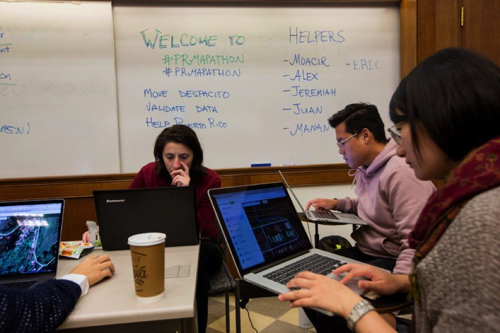
Volunteers using satellite imagery and open-source mapping software in a mapathon at Columbia University on Friday to help with the humanitarian effort in Puerto Rico. Credit: Caitlin Ochs for The New York Times / https://www.nytimes.com/2017/10/02/nyregion/maps-puerto-rico-hurricane-maria.html
Any type of disaster event—ranging from geological, meteorological, biological, man-made, to intentional—may result in a massive toll on human life, billions of dollars in property damage, and the financial crippling of corporations in the geographic areas of impact. To respond to a disaster and later analyze the effects on a region’s population and economy, layers of data can be added to a GIS map display. Items like building footprints, flood plains, contoured elevation, property zoning, resident locations, evacuation routes, and relief supply sites assist in the analysis of relief and recovery.
However, a GIS is only as good as the information it contains. Many areas of the world lack up-to-date online maps showing all streets, landmarks, and/or building information; this lack of information slows the response time of emergency and aid workers. The availability of open access maps and calls for crowdsourcing to provide updates in times of crisis can speed up response time and recovery efforts. For example, compare maps of Nepal before and after the 2015 earthquake—the public contributions post-earthquake add many details that were missing:

Source: http://pierzen.dev.openstreetmap.org/hot/leaflet/OSM-Compare-before-after.html#16/27.7269/85.3268
Open access GIS and geospatial resources rely on contributions from users. Public participation in these maps impacts responses to natural disasters, humanitarian aid, public affairs, environmental issues, public health, and policy making.
Sharing data with or adding locations to an open access mapping platform is a tangible way to make a difference following a natural disaster (areas prone to disaster that lack adequate map coverage and data are good candidates for street and building additions on the same platforms at any time). Contribute your knowledge, data, or time to the existing geographic data coverage with the following geospatial resources:
- Humanitarian OpenStreetMap Team: When major disaster strikes anywhere in the world, HOT rallies a huge network of volunteers to create, online, the maps that enable responders to reach those in need.
- OpenStreetMap: Built by a community of mappers that contribute and maintain data about roads, trails, cafés, railway stations, and much more, all over the world.
- OpenAerialMap: an open service to provide access to a commons of openly licensed imagery and map layer services. Download or contribute imagery to the growing commons of openly licensed imagery.
- Wikimapia: A multilingual open-content collaborative map, where anyone can create place tags and share their knowledge.
- Ushahidi: A non-profit tech company that develops free and open source software for information collection on disaster situations, visualization and interactive mapping.
- Geonode: By combining collaboration found in social networks with specialized geospatial tools, GeoNode makes it easy to explore, process, style, and share maps and geospatial data.